Inventories, missions, and scientific monitoring help improve knowledge about the species and environments present on the island. Determining the most sensitive species and environments, monitoring their evolution, identifying regulatory measures or actions to be implemented, and verifying the effectiveness of the measures taken are among the objectives of this monitoring.
This type of monitoring aims to track changes in habitats and the populations that inhabit them. Phanerogam meadows and coral reefs are the two main habitats monitored. Some monitoring is carried out by specialists or consultancy firms. Others are carried out in-house or with the help of volunteers.
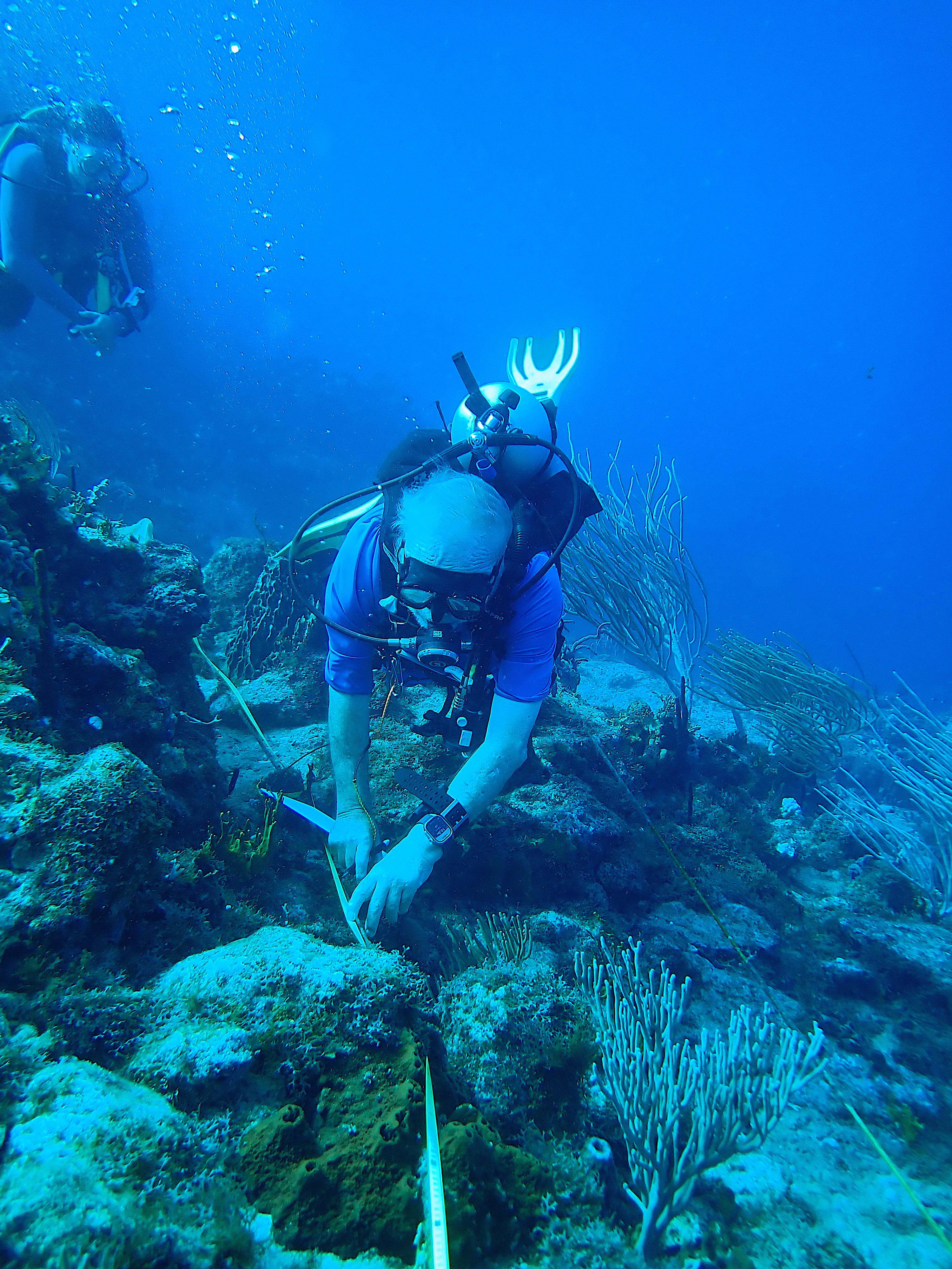
Launched in 2018, Reef Check monitoring uses a standardized protocol deployed worldwide with the support of volunteers. Three reef stations are monitored each year thanks to technical support from the Guadeloupe-based association V-REEF and the participation of divers from the island.
Common to all French nature reserves in the Antilles, this monitoring program assesses the health of seagrass beds and reefs inside and outside the reserve. Three reef stations and two seagrass bed stations are monitored each year.
Established in 2002 by Claude and Yolande BOUCHON, emeritus professors at the University of the Antilles, this monitoring program has highlighted the “reserve effect,” i.e., the positive impact of designating certain areas as nature reserves.
The results showed that species richness, fish abundance, and biomass were higher in the reserve than outside it. Unfortunately for corals, the results confirm the general decline they are experiencing in the Caribbean region. The abundance of coral colonies has declined, as has the coverage rate of the seabed, particularly as a result of coral tissue loss disease (SCTLD) and episodes of coral bleaching.
Having up-to-date maps of marine habitats is essential for monitoring their evolution. This makes it possible to identify the most sensitive areas and raise the alarm when a project is likely to impact them. The last mapping dates back to 2013. In 2023, new mapping was carried out for depths of 0m to -18m and is currently underway for depths of -18m to -30m.
One of the main uses of these maps is to enable everyone to anchor outside sensitive areas, in particular through the DONIA application.
Every month, the water quality of Petit and Grand Cul-de-sac bays, Marigot, and the ponds in these areas is monitored by an ATE agent. This monitoring aims to ensure the good physical and chemical quality of these environments, to alert in case of unusual results, and to identify possible causes of pollution. This topic was also addressed by Jason FRANCHET during his internship in 2023, as documented in his internship report.
Saint Barthélemy has a wastewater treatment plant that treats sewage from Gustavia. With the support of a consulting firm, the ATE monitors changes in the health of benthic populations and the quality of the environment in the area affected by the discharge.
In partnership with Reef Pulse, two hydrophones were recently installed at two different points on our reefs around the island.
This equipment records the sounds emitted by reef fauna (fish, crustaceans, mollusks, corals, etc.) as well as human activity on the site, known as the “soundscape.” The recordings will be made over a period of one year, after which they will be sent to a partner company based in Réunion that specializes in the study of aquatic sounds, before the hydrophones are returned to the water for another year.
The information gathered will provide an understanding of the species that inhabit our reefs and the variations and fluctuations that occur throughout the year (circadian cycle (day/night, lunar cycle, time of year, etc.), giving us an idea of the population of our reefs and the phenomena that may impact it. All of this tells the story of the reef throughout the period monitored.
Subsequently, some recordings, with background noise removed, may be replayed on reefs in poorer condition to make them more attractive to wildlife and help them repopulate.
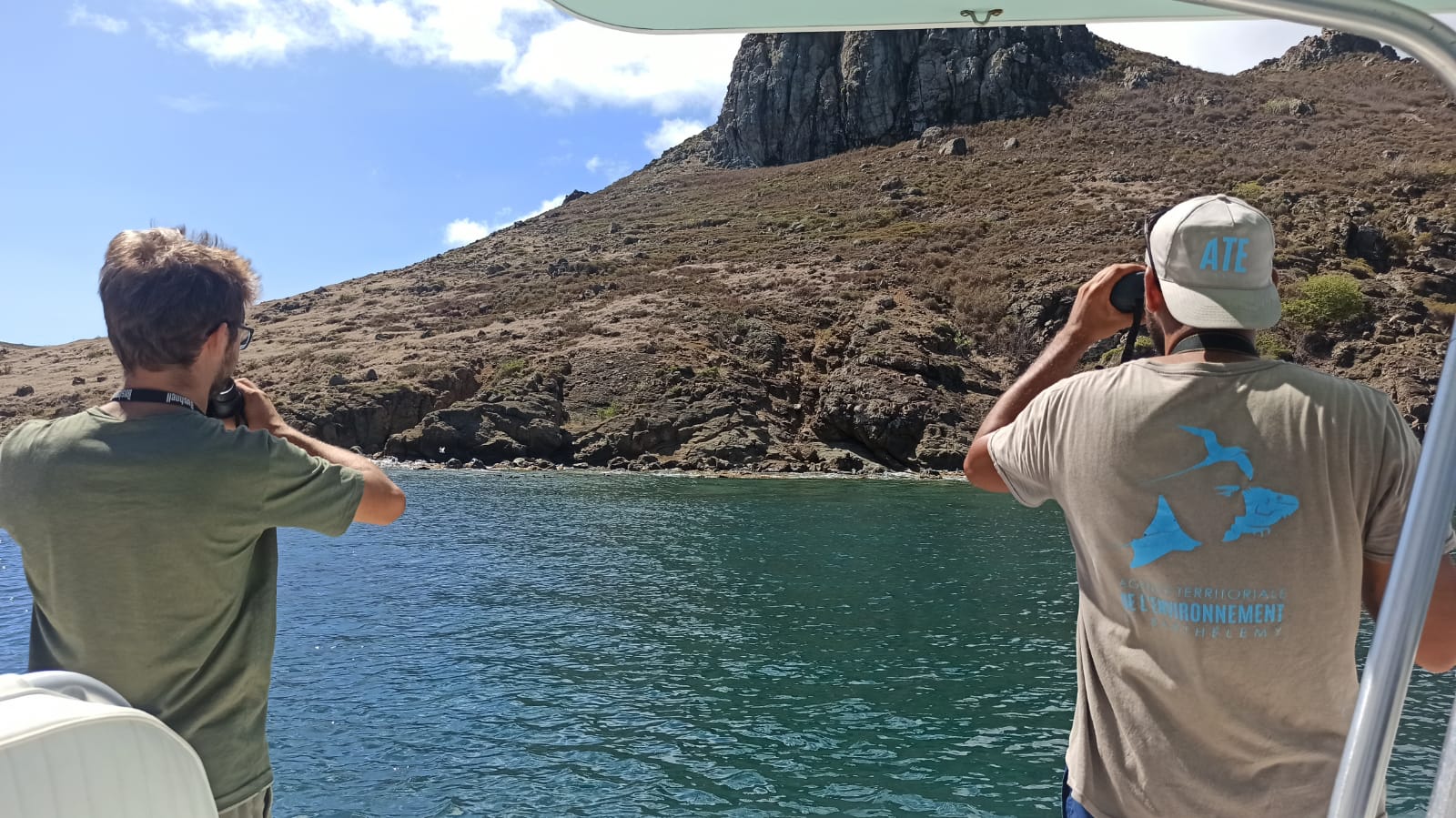
Several monitoring programs are carried out regularly in Saint Barthélemy: sharks, rays, sea turtles... certain sensitive species are monitored regularly in order to track changes in their populations.
Other species are known as indicator species, whose presence or absence are warning signs of environmental disturbance, imbalance, or specific pollution.
These monitoring activities provide us with additional knowledge that guides the decisions of the Territorial Environment Agency in its actions to preserve indigenous biodiversity and in its recommendations for changes to regulatory texts.
This monitoring, carried out with the REGUAR association, represented by Océane BEAUFORT, has enabled us to identify the main species of rays and sharks that frequent our waters, and to monitor their abundance, state of maturity, reproduction period and current fishing zone.
This monitoring has led to the implementation of conservation measures through fishing regulations in the waters of Saint Barthélemy.
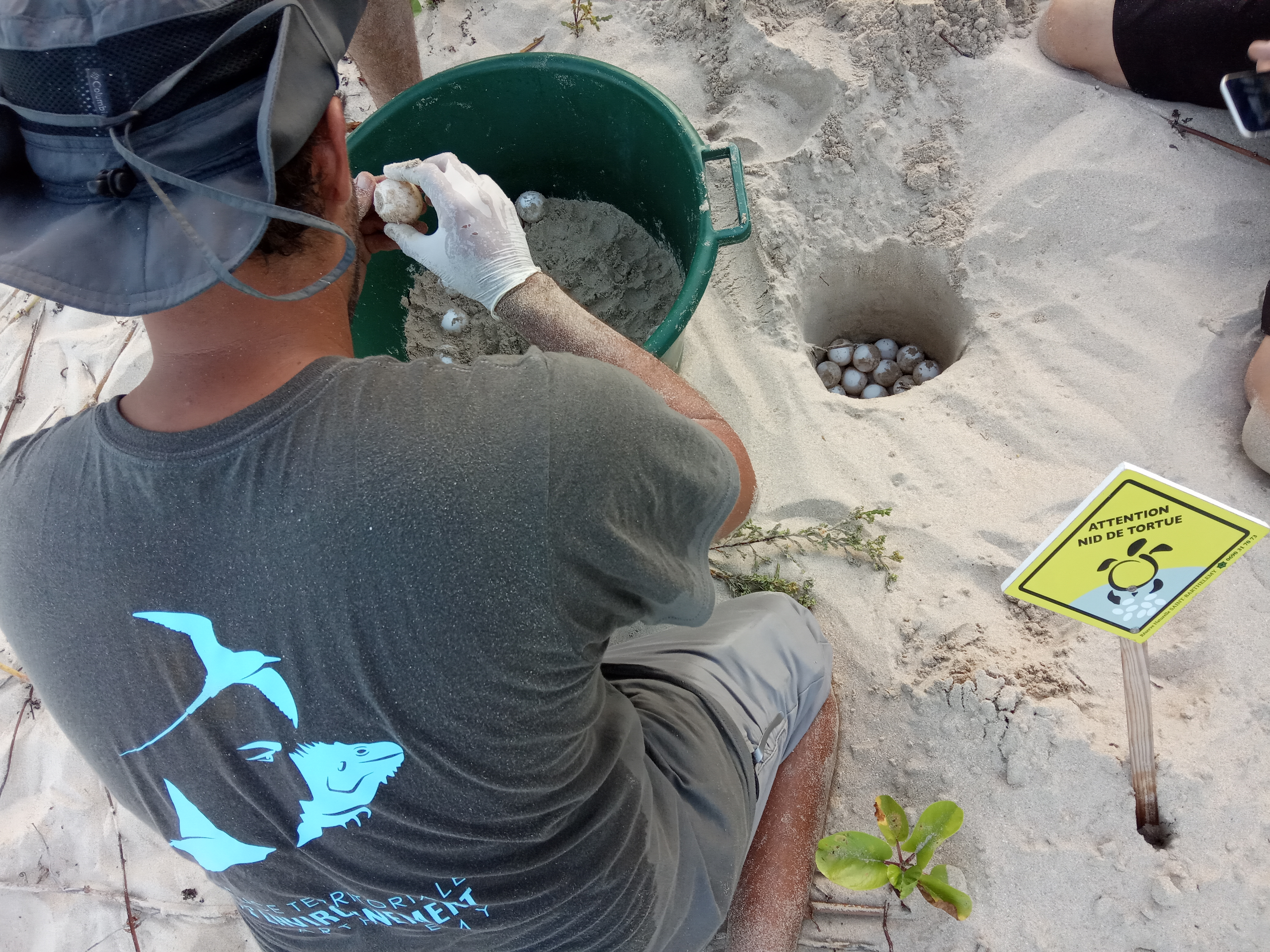
Every year, the beaches of Saint-Barthélemy play host to marine turtle egg-laying (the green turtle Chelonia mydas, the hawksbill turtle Eretmochelys imbricata and occasionally the leatherback turtle Dermochelys coriacea).
This monitoring program, mainly carried out by volunteers, involves surveying the beach early in the morning, before it is frequented, to detect any signs of egg-laying or emergence. Each species of turtle leaves a different trace on the sand, depending on how it gets up the beach to its nesting area, which also differs from species to species, ranging from the open beach for the leatherback turtle to the seaside vegetation for the hawksbill turtle.
The exact location of the nest makes it possible to protect it by marking it out during incubation; but also, once emergence has passed, to enable authorized ATE agents to excavate the nest and calculate the nest's success rate. These results enable us to monitor the quality of egg-laying sites and identify any damage caused by natural causes (heavy rainfall, cyclonic swell) or human activity (fire on the sand, machine traffic, urbanization, etc.).
This monitoring is the result of 154 surveys which have identified more than 500 green turtles living around the island. This identification is based on anatomical criteria that are enriched over the years. This monitoring shows the age range, state of health and injuries of these turtles.
Thanks to Mayalen Zubia and Christophe Vieira, an initial inventory of algae has been carried out in our waters. One of the aims of this inventory is to identify which species are present and which ones are proliferating, indicating pollution.
The conch is one of the most heavily fished species in the Caribbean region. Responsible for managing fishery resources, the ATE has set up a monitoring program to track changes in conch stocks in the waters around Saint Barthélemy.
Marine mammals present in our waters are not routinely monitored, but each sighting is recorded.
Species, area, number of individuals, behavior... all this information is important for improving our knowledge of these giants, so please don't hesitate to pass it on to us if you are lucky enough to encounter them.
As part of the CARI'MAM project led by the AGOA Sanctuary, Saint Barthélemy has been selected as a pilot site for the deployment of hydrophones designed to record the sounds of marine mammals. These recordings are currently being processed.
Grand Cul-de-Sac Bay, part from St Barts Marine Park, is home to one of the island's largest coral reefs. This reef, which is almost entirely composed of single-species eland horn coral (Acropora palmata), has been monitored using an innovative technique called photogrammetry, which allows the exact position, size, and volume of the reef to be determined with centimeter-level precision, both as a whole and at the level of each colony.
Repeated over time, this monitoring will make it possible to:
map areas that are growing or shrinking,
identify the causes and rate of change,
document and illustrate the impact of phenomena such as coral bleaching or cyclones.
Discover the 3D model of this reef.
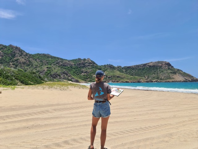
Since 2023, Anaïs COULON -Doctor of Geography, specializing in disaster management and natural hazards- has been working on a thesis on the island's coastlines. More specifically, she is studying the island's beaches: their evolution, erosion and causes. The aim is to provide guidance to the Territorial Environment Agency on actions to be taken to curb beach erosion on Saint-Barthélemy.
This topic had already been addressed during an internship in 2016 at our premises by Maud Le NAGARD and highlighted in her internship report.
A continuous inventory, enriched by targeted missions, now lists more than 2,700 taxa (1,985 animals and 715 plants, updated December 2024). This work highlights the island's biological richness and the importance of monitoring it.
Monitored since 2011 using capture-mark-recapture techniques, 758 individuals have been tagged, providing key data on their biology and distribution. But the threats are serious: 55 deaths caused by domestic animals (16%), 247 by vehicles (73%), and 7 by other human causes (2%).
The most endangered species on the island, the snake remains poorly understood despite its major conservation importance. Monitoring involves transects, targeted counts, and opportunistic observations, supplemented by ecological data (reproduction, diet).
Five species have been recorded, with populations often declining. Increased public visitation to caves and shelters is a major cause of these declines. A report has been drafted but has not been published in order to protect sensitive sites.
Monitored every month since 2011, they show a decline in numbers and species richness. This trend highlights the fragility of wetlands and the need to strengthen their protection.
Report on the Ten-Year Evolution of Waterbirds in Saint Barthélemy (Lesser Antilles) 1999 to 2024
Counted annually since 2011, their numbers are increasing significantly (1,122 in 2023, 1,374 in 2024) despite reduced monitoring. The colonies are showing positive dynamics but require constant monitoring.
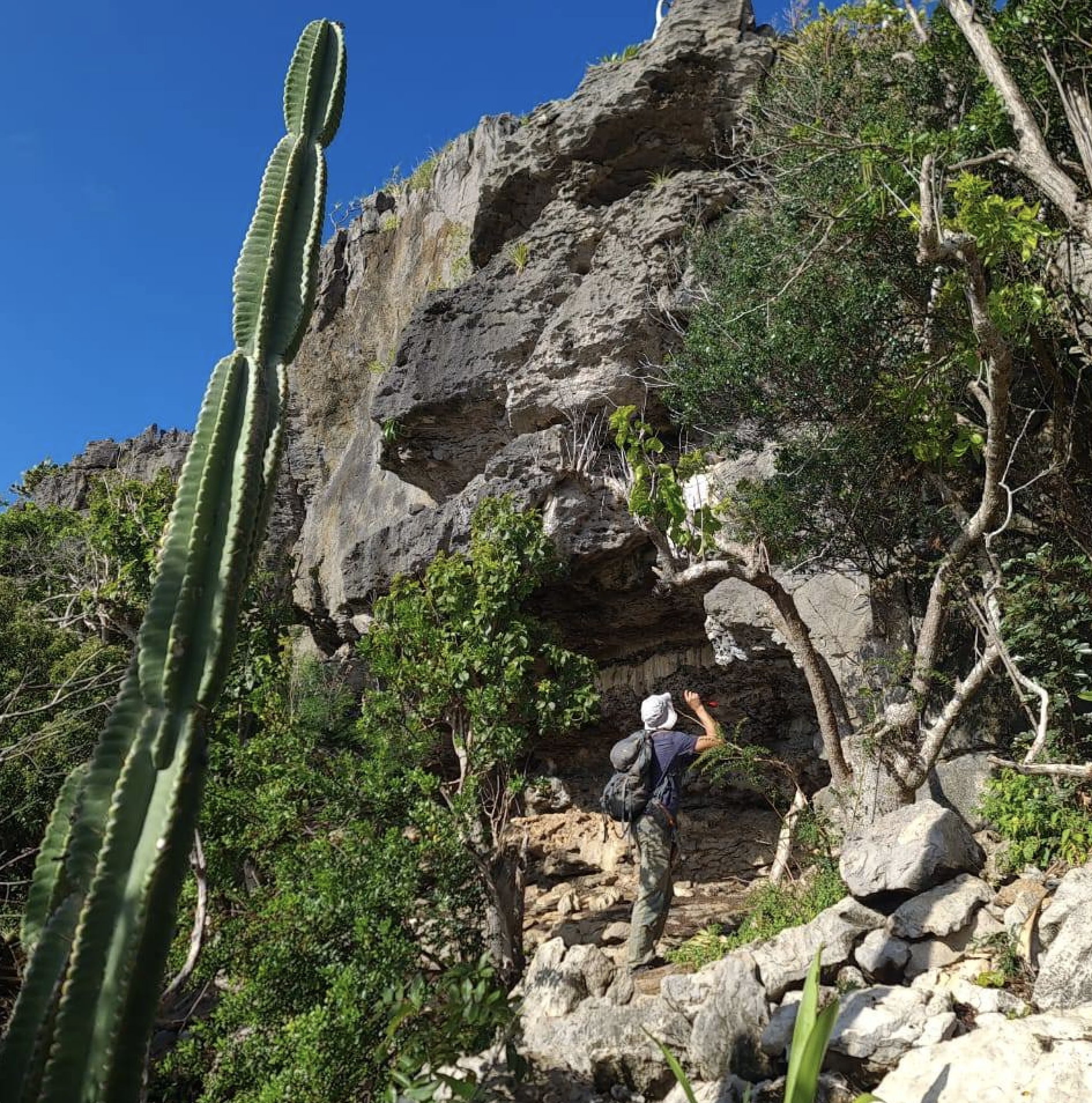
Throughout the year, we explore the island's most natural areas—Morne de Grand-Fond, Pointe de Gouverneur, the former Flamands ranch, Morne de Petite Saline, Grand Colombier, etc.—to map the flora of Saint Barthélemy. These surveys identify trees, shrubs, and herbaceous plants, detect the appearance and disappearance of species, and document flowering and fruiting seasons. We also collect seeds for the nursery and for species reproduction and reintroduction projects. When a remarkable species of fauna is encountered, it is reported and mapped. When a remarkable species of wildlife is encountered, it is reported and mapped on Inaturalist (see “Taking action by participating on a daily basis”).
Using quadrat surveys in dense areas, we measure the population status (adults, juveniles, and mortality) of Melocactus intortus, also known as “Turk's Head.” Mortality measurements quantify the impact of the Cactoblastis cactorum moth caterpillar and grazing by goats.
At Grand-Fond, we combine drone shots (2–3 times/year) of the overall beach vegetation with bimonthly monitoring of individuals of Tournefortia gnaphalodes (known as white seaside rosemary). The goal is to visualize how the vegetation cover is changing in response to weather conditions, urbanization, and pressure from the Utetheisa pulchella caterpillar on Tournefortia g. This dual approach, which combines panoramic views with close-up shots of the plants, allows us to evaluate coastal conservation measures to be implemented.
Every year, the Fort Carl Land-based Educational Area welcomes new plantings of native species. We closely monitor the recovery, growth, and ultimately the phenology (flowering/fruiting cycles) of each taxon in order to calibrate the ideal conditions for restoration (soil, exposure, watering, care). This site involves young people and the public, raises awareness, and serves as an open-air laboratory to improve our reforestation and reintroduction practices. Individual monitoring of species improves our knowledge of each one.
In addition, from November to February—the most favorable period for rooting—we carry out planting in various areas of the island, using plants from the nursery or schools. The goal is to regreen the most impacted areas and recreate habitats suitable for wildlife.
Since 2022, germination tests have been conducting to better understand germination capacity, emergence times, and storage methods suitable for native species. Some seeds require rapid sowing after harvest, while others can be stored for several years: our protocols distinguish between these cases and optimize propagation to support planting and reintroduction efforts. Ultimately, these tests transform detailed knowledge of species into concrete conservation actions in the field.